Published
Tropical Storm Bret sets sights on Lesser Antilles
FOX 13 Meteorologist Jim Weber says the tropics are active as he keeps an eye on Tropical Storm and Invest 93L, which is likely to develop into a tropical system within the next two days. Weber says wind shear will create a hostile environment for both storms, but Invest 93L will also head into warm waters that are conducive for further development. He says Tropical Storm Brett may weaken due to wind shear if it tracks a little south, but if it tracks north without the wind shear it may develop into a hurricane.
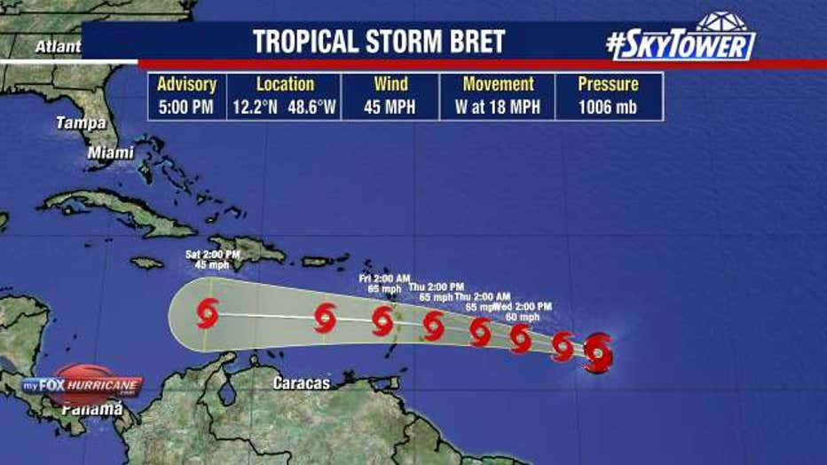
TAMPA, Fla. – Tropical storm conditions are expected to develop across some of the Lesser Antilles Thursday afternoon and evening as Bret approaches the Caribbean Sea.
As of the 5 p.m. advisory from the National Hurricane Center, Tropical Storm Bret has winds topping 45 miles per hour and was traveling west at 18 miles an hour. The storm did gain a little strength from this afternoon and a Tropical Storm Watch was issued for Barbados.
STAY CONNECTED: Download the free FOX 13 News app for Live SkyTower Radar, forecast videos, and more weather coverage

But, FOX 13 Chief Meteorologist Paul Dellegatto said once Tropical Storm Bret gets into the Caribbean Sea, it will encounter hostile upper level winds. This will induce weakening and Bret is expected to dissipate by the weekend, Dellegatto said.
READ: How El Niño, ‘freakish’ warm oceans may impact hurricane season
The National Hurricane Center’s 5 a.m. advisory on Tuesday said Tropical Storm Bret will likely cause flooding due to heavy rainfall, strong winds, dangerous storm surge and waves.

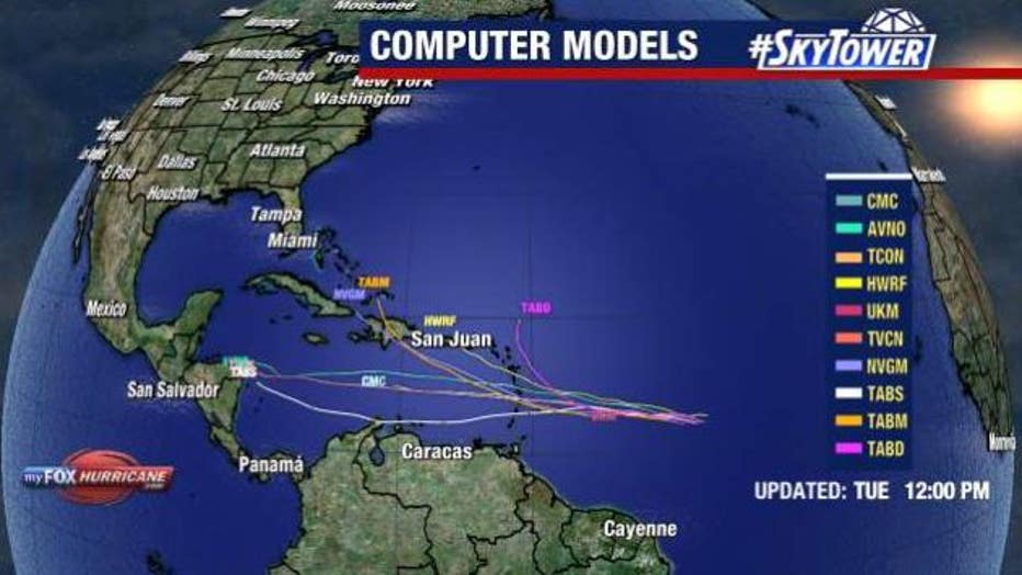
Since it is too early to predict Tropical Storm Bret’s path, the NHC is advising everyone in the Lesser Antilles, Puerto Rico and the Virgin Islands to have their hurricane plan in place.
READ: Experts increase number of storms expected in 2023 Atlantic hurricane season
It should not impact Florida or the United States, Dellegatto said.
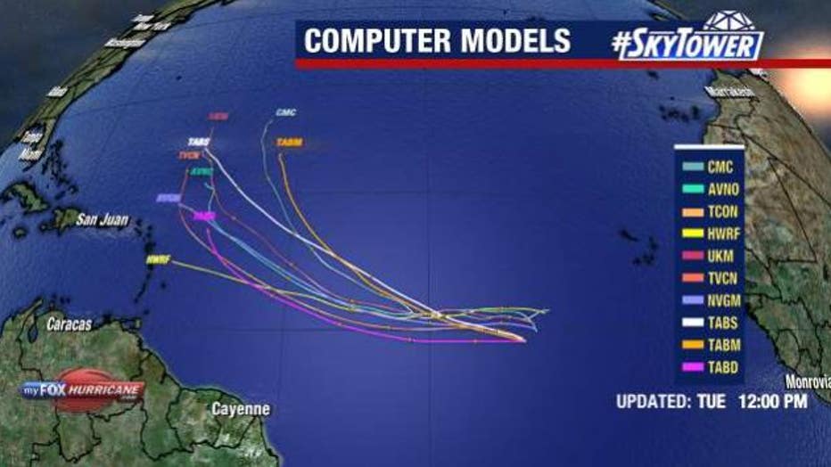
Behind Bret, meteorologists are watching Invest 93L, which has a 60% chance of developing over the next two days.

Shortly before noon, FOX 13 Meteorologist Jim Weber said Invest 93L had a big build up in convection during the overnight hours, but he is seeing that die off as it encounters drier air. He said though it is fairly disorganized as of noon on Tuesday, it is moving through an area of warm water and low wind shear that is conducive for development.
The good news is that most of the models are keeping Invest 93L out to sea.
The next named storm will be called Cindy.


