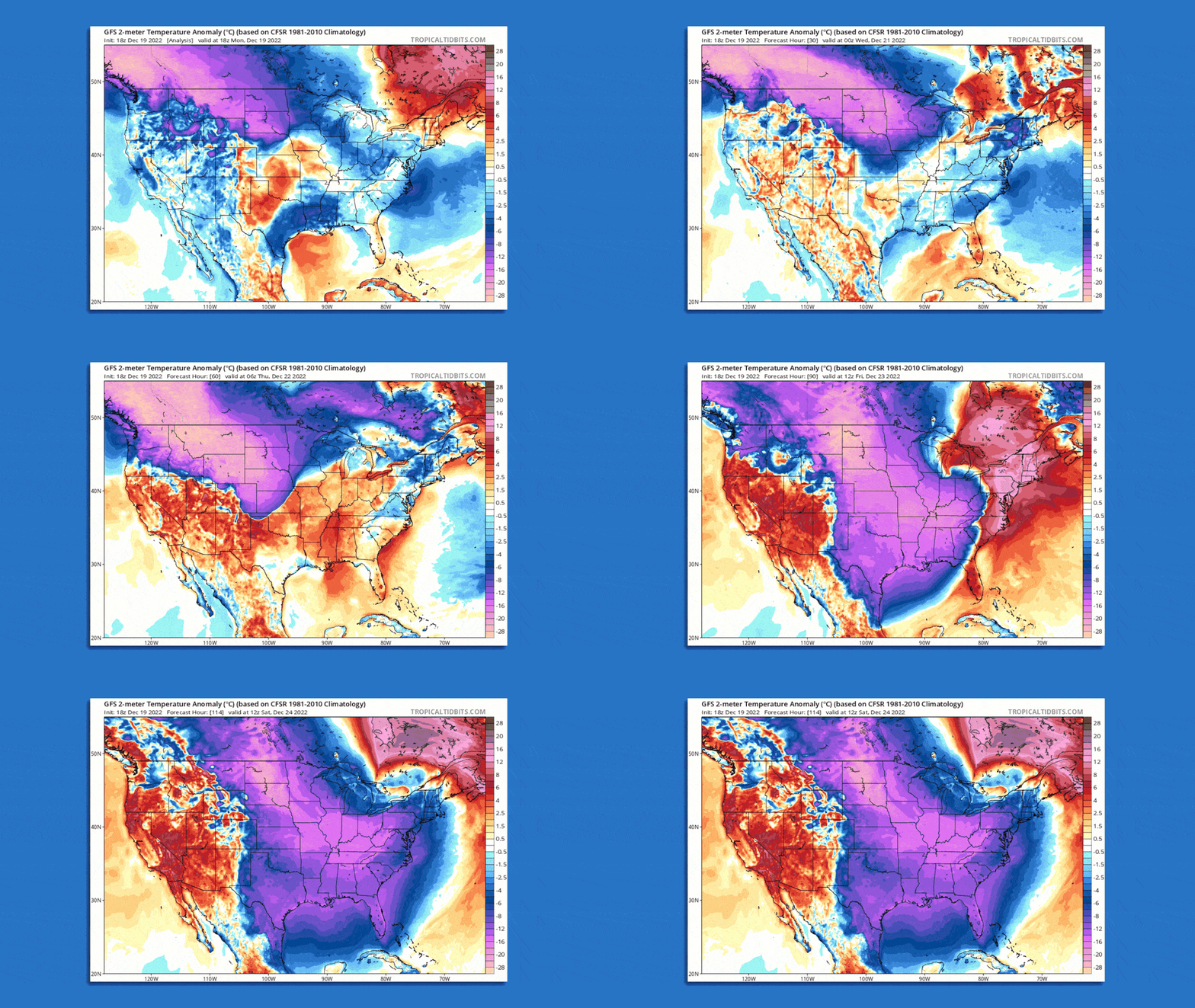
Animation of modeled temperature departures from average through Dec. 24. Image: Tropicaltidbits.com
The frigid air is already slithering south of the Canadian border, and will soon roar across virtually the entire Lower 48 east of the Rockies.
Threat level: The National Weather Service is calling the cold “life-threatening” for the areas that will be hardest hit, especially the Great Plains and Midwest.
- In the coldest areas, the combination of high winds and frigid air mean frostbite will be possible for anyone caught unprepared outside for as little as 10 to 20 minutes.
- Already Tuesday morning, 17 states were under wind chill warnings, advisories and watches as the cold readies its advance.
- The contrast in air masses along the strong Arctic front, combined with a jet stream disturbance, will spawn a potent blizzard that will affect a huge expanse from tomorrow through early this weekend — one of the busiest travel periods of the year.
What is a “bomb cyclone” blizzard?
Zoom in: Blizzard conditions are forecast between early Thursday and Friday night from Kansas City, Missouri, to the Michigan border with Canada. Chicago, northern Indiana and western Michigan may take the brunt.
- The NWS forecast office in Chicago warned of “a significant threat to life for anyone stranded in the storm,” and noted in an online forecast discussion that computer model projections show consistent signals for an “extreme event” with damaging winds greater than 55 mph during the height of the snowstorm.
- The storm is likely to qualify as a “bomb cyclone” since it will intensify at a rapid rate, through a process known as bombogenesis. Such storms typically are seen along the East Coast, but they can occur in the Midwest as well.
- The NWS, in a forecast discussion, notes the storm will intensify “explosively,” while the NWS office in Buffalo is describing the storm as a “once in a generation type event.”
- Widespread power outages from damaging winds are likely across the Midwest, Ohio Valley, Mid-Atlantic and New England, as strong winds whip around a rapidly intensifying low-pressure area in the Great Lakes.
- Outages related to the strong cold front could occur in the South, Southeast and up and down the East Coast, too.
Between the lines: Some areas may even set records for their biggest temperature plunge in a short period of time, with computer models showing the potential for a “flash freeze” as the temperature drops 30°F to 40°F in just three hours. This sudden chill will be accompanied by strong winds.
- The NWS in Denver warns the city is likely to see its coldest day in 32 years on Thursday.
- Between the blizzard in the Plains and Midwest and heavy rain in the East, along with the broad footprint from the Arctic front, it’s likely that thousands of flights will be delayed or canceled during the run-up to Christmas weekend.
Context: Extreme cold still occurs in a warming world, though it is becoming less severe and of shorter duration.
- In the U.S., most states east of the Rockies have been warming the fastest during winter. This cold snap, while headline-grabbing, is unlikely to smash records from particularly cold years in the 1980s or earlier to establish new all-time milestones.
- There is also an active scientific debate regarding the effects of rapid Arctic warming, and if it is altering the jet stream in ways that favor more frequent southern cold intrusions.
The big picture: While millions of people deal with the consequences of the storm, with multiple international air travel and shipping hubs likely affected simultaneously, the cold will set scattered records across the Plains, South, Southeast and eventually the East.
- In Texas, which suffered a massive failure of its power grid in February 2021, this round of cold will not be accompanied by as much snow and won’t be as prolonged.
- However, it could pose a danger to energy infrastructure that is still vulnerable to extreme cold and high winds.
- In the Plains, the cold may rival anything experienced in the past three decades, with wind chills as low as minus-40°F to minus-60°F in the Dakotas, parts of Montana, parts of Colorado and Nebraska.
Go deeper: Major winter storm threatens to upend holiday travel


